
Engineering Field Mission
Differential Leveling with the Smart Survey Notebook
CST Level 1 | Engineering Field Lab
Field Mission
CST · LVL‑01
Your engineering crew ships out today. Gear check, then the field.
Do Now · Field Preparation
Gear Up: Equipment Checklist
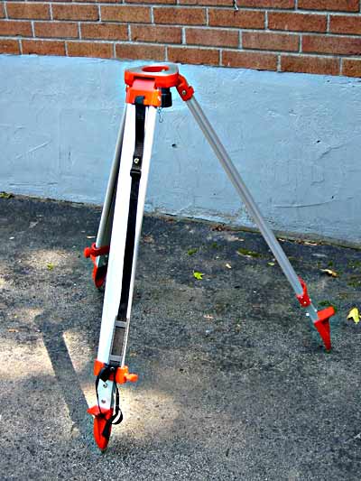
Tripod

Level Rod

Tablet / Laptop

Safety Vest

Measuring Tape
Photos via Wikimedia Commons: Automatic Level (ノボホショコロトソ, CC BY 4.0) · Tripod (Michael Daly, CC BY-SA 3.0) · Level Rod (Manuguf, CC BY-SA 3.0) · Tablet (Pengjiajie, CC BY-SA) · Safety Vest (Magnus Mertens, CC BY-SA 2.0 DE) · Measuring Tape (Evan-Amos, public domain)
Engineering Mission · Essential Question
How do you, as an engineer, transform field measurements into accurate elevation data that helps improve the spaces where people live, learn, and move?
NYC engineers need accurate site information before improving streets, parks, and public spaces. Today, your engineering team will collect elevation data and create a professional survey record.
Today's Objectives
Engineer Skills You'll Use Today
Measure
Operate leveling equipment and collect accurate field data.
Document
Use the Smart Survey Notebook as a digital field notebook.
Calculate
Determine Height of Instrument and elevations manually.
Communicate
Create a professional survey deliverable.
CDOS 3a · NGSS HS-ETS1-3 · CCSS.ELA-LITERACY.RST.11-12.3
Field Terminology
Key Vocabulary
A quick refresher. Hover or tap a card to reveal its definition.
Benchmark (BM)
A point with a known elevation, used as your starting reference.
Backsight (BS)
The first rod reading, taken looking back at a point of known elevation.
Foresight (FS)
The final rod reading, taken looking ahead before the instrument moves.
Turning Point (TP)
A stable point used to carry elevation from one instrument setup to the next.
Height of Instrument (HI)
The elevation of the instrument's line of sight above your datum.
Elevation
The vertical position of a point relative to a reference elevation.
Digital Field Notebook
A technology-based field record used to collect, organize, and communicate survey information.
Survey Workflow
The process of collecting, documenting, reviewing, and presenting professional survey data.
Quick Refresher
How Differential Leveling Works
The same diagram from your last lesson. A quick recall before we head out.
BM
TP 1
TP 2
HI = Elevation + Backsight
Elevation = HI − Foresight
Your Mission
The Engineering Challenge
Mission Brief
Complete a professional differential leveling survey.
Tap each item off as your team completes it.
- Establish Benchmark (Elevation = 100.00 ft)
- Collect a minimum of 10 Turning Points
- Record BS and FS observations
- Record distances and descriptions
- Add notes and photos
- Export Smart Survey Notebook PDF Report
Your Digital Field Book
Meet the Smart Survey Notebook
Time to Deploy
Let's Head Out!
Open the Smart Survey Notebook, confirm your role, and head to Fort Greene Park to establish your benchmark.
Launch Smart Survey NotebookSafety
- Protect equipment
- Be aware of surroundings
- Communicate clearly
- Never leave equipment unattended
Team Roles
Instrument Operator
Rod Person
Digital Recorder
Survey Assistant
Quality Control Engineer
CS3 Smart Streets Connection
Community Engineering Observation
“How does this space work for the people who use it every day?”
Pedestrians
Wheelchair Users
Cyclists
Children
Older Adults
Accessibility
Drainage
Safety
Pathways
Wrap-Up
Return to School: Engineering Closeout
- Return equipment
- Inspect tools
- Verify digital records
- Review survey data
How You'll Be Evaluated
Deliverables & Assessment
Digital Deliverable
Smart Survey Notebook PDF Survey Report
Exported directly from your team's completed Differential Leveling Run.
Manual Deliverable
20″ × 30″ Survey Plan Draft
A hand-drafted plan built from your own field data.
Formative
- Equipment use
- Field documentation
- Team collaboration
Summative
- Survey report
- Calculations
- Drafting accuracy
Exit Ticket
Reflection
Question 1
How did your field measurements become elevation data?
Question 2
What challenges affected your survey accuracy?
Question 3
How can engineers use survey data to improve public spaces?
Mission complete. Submit your reflection and your team's Differential Leveling Run.